
Did you know that people grow crops in the Galapagos Islands? Before tortoises and blue-footed boobies drew hundreds of thousands of annual visitors to the “Enchanted Islands”, agriculture used to be the region’s main economic engine. Agricultural areas in the Galapagos are entirely surrounded by protected areas, which means that whatever happens on one side will inevitably affect the other side. However, productive areas and protected areas are are often conceptualized and managed separately from protected areas.
Francisco Laso, a recent geography PhD candidate, bridges these two dimensions in his project “Agriculture, Wildlife and Conservation in the Galapagos Islands”. Francisco combines both quantitative and qualitative data to analyze the socioeconomic and ecological dimensions of agroecosystems in the Galapagos. As part of this project, he is creating the first high-resolution land cover map of agricultural areas in the Galapagos, which will be useful for both conservation and agricultural sectors.
This work is made possible by the generous contributions of both UNC and external sources. Francisco received the Off-Campus dissertation Fellowship from the Graduate School for the Fall 2018 as well as the Chancellor’s Doctoral Candidacy Award from the Institute for Minority Excellence. Additionally, World Wildlife Fund awarded Francisco the Russel E. Train Fellowship, a very competitive two-year fellowship for doctoral projects that work towards conservation of the Galapagos Islands.
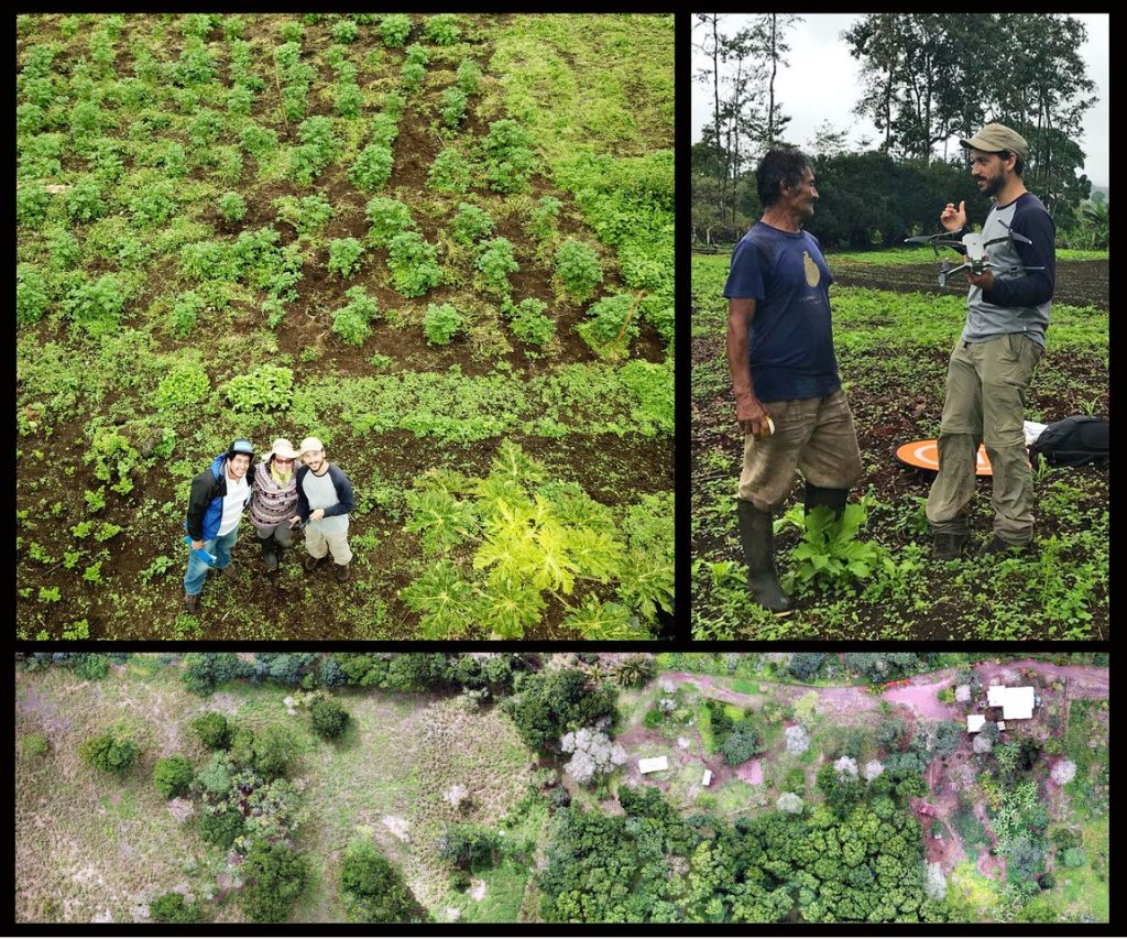
Francisco standing alongside farmers of Santa Cruz Island as he uses a drone to collect aerial images of their farms for the mapping process.