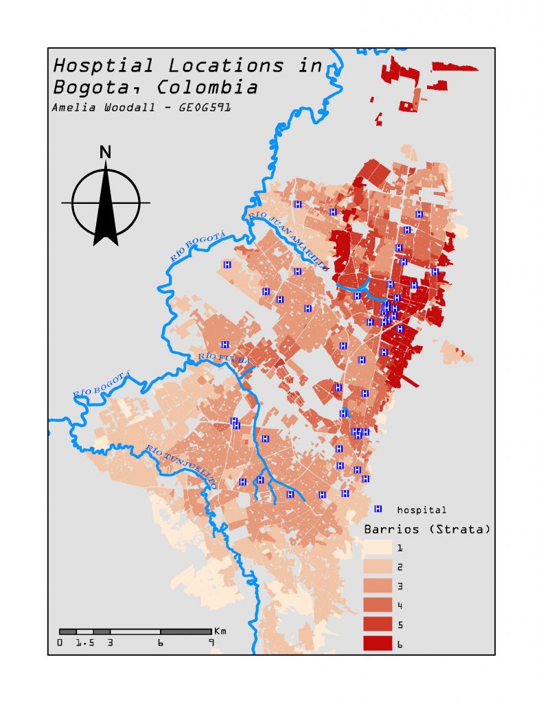
Geography minor Amelia Woodall (Also a minor in Geographic Info Sciences, a ENEC major) receives second place in 2020 UNC GIS Day Map Contest. Her map title is “Hot and Cold Spot Analysis of Hospital Locations in Bogota, Colombia”.
Descriptions about this map from Amelia:
“The first map shows a choropleth map of Bogota, Colombia based on barrio (neighborhood) strata levels 1-6. 1 represents a “low-low” socioeconomic class while 6 represents “very wealthy/high-high” socioeconomic class. The zones where the choropleth map is not filled are strata of level 0 (industrial zones or plazas, i.e. non-residential). The goal of this map is to demonstrate where the hospitals are located within Bogota compared to the strata level. This analysis of micro-segregation based on class (strata level) is based on hospital resource accessibility. The hot/cold spot analysis uses the hospital locations at various cell sizes to demonstrate the regions within Bogota where statistically significant hot and cold spots of hospital locations exist. When comparing the hot/cold spot maps to the choropleth map, it is clear that the higher-level strata are hot spots for hospital locations while the lower level strata are lean-to being more insignificant or cold spots based on the cell size. The results show that geographically, more hospitals are spatially located in barrios with higher-level strata, creating class segregation within the city.”


